Last Updated: April 2026 | Based on FEMA, NOAA, and USGS data
California has recorded 151 federally declared disasters since January 2016, more than any other state in that window. Of those, 121 were wildfires. That number alone reshapes how residents of Crescent City should think about emergency planning: tsunami risk is real and historically documented here, but the day-to-day threat landscape in this state is dominated by fire, and the most recent FEMA activations confirm that pattern isn’t slowing down. As recently as May 2026, California was responding to both a chemical release and two active fire declarations simultaneously. Crescent City sits at the intersection of two distinct hazard worlds, a Pacific coastline that geologists rank among the most tsunami-exposed in the continental U.S., and a Northern California fire and weather environment that demands its own parallel set of preparations. Our Tsunami Preparedness guide covers that coastal half of Crescent City’s risk in full.
Your county's real disaster history, what to do first, and what to keep at home. Free, and it shows up right here.
🔒 We never sell your email. Unsubscribe in one click.
📊 CA Federally Declared Disasters (2016–2026)
151 major disaster declarations were issued for CA in this period, according to FEMA records.
| Disaster type | Declarations |
|---|---|
| Fire | 121 |
| Severe Storm | 14 |
| Flood | 6 |
| Hurricane | 2 |
| Earthquake | 2 |
| Biological | 2 |
| Chemical | 1 |
| Tropical Storm | 1 |
Most recent declarations
| Date | Type | Event |
|---|---|---|
| 2026-05-25 | Chemical | Chemical Release |
| 2026-05-20 | Fire | Bain Fire |
| 2026-05-18 | Fire | Sandy Fire |
| 2025-09-03 | Fire | 2-7 Fire |
| 2025-08-08 | Fire | Canyon Fire |
| 2025-01-08 | Fire | Wildfires And Straight-Line Winds |
Source: FEMA OpenFEMA Disaster Declarations · retrieved 2026-07-19 by US Risk Radar.
Why Crescent City’s Tsunami Exposure Is Unlike the Rest of the California Coast
Most California coastal cities face generic Pacific tsunami risk. Crescent City faces something more specific. Its harbor geometry, a shallow, concave bay, acts as a natural amplifier for incoming wave energy. This isn’t speculation: the 1964 Alaska earthquake sent tsunamis up and down the West Coast, and while other California ports saw modest surges, Crescent City recorded a 21-foot wave and lost a significant portion of its downtown. USGS and NOAA data both point to the Cascadia Subduction Zone, a 700-mile fault running offshore from Northern California to British Columbia, as the dominant long-term threat. A full Cascadia rupture could produce a magnitude 9.0 or greater earthquake with very little warning before wave arrival.
The critical point NOAA makes is that for a local-source tsunami like a Cascadia event, the shaking itself is your warning. Sirens may not activate in time. If you feel prolonged, violent shaking while anywhere near the Crescent City waterfront, do not wait for an official alert, move uphill immediately. The designated evacuation routes are marked throughout the city, and the target elevation is at least 100 feet above sea level. Del Norte County’s Office of Emergency Services maintains updated zone maps that residents should review before they ever need them.
The Wildfire Angle Crescent City Residents Can’t Ignore
Of California’s 151 federally declared disasters since 2016, 80 percent were fires. The most recent FEMA activations on record include the Bain Fire (May 20, 2026), the Sandy Fire (May 18, 2026), the 2-7 Fire (September 2025), and the January 2025 cluster that included the Eaton Fire, Hurst Fire, and a straight-line wind event, all declared within the same 24-hour window. Northern California’s fire season now stretches into months that previously offered a reliable break.
Crescent City’s coastal humidity provides some buffer, but the forests of Del Norte and Siskiyou counties are dry enough in late summer and fall to carry fire at speed. Highway 101, the primary evacuation artery, can close in both directions during a major fire event, creating the same isolation problem that a tsunami surge would cause. Residents who plan only for one hazard are underprepared for how these risks interact. A wildfire evacuation order and a tsunami watch can, in theory, arrive within the same weather window.
The practical implication: your evacuation plan needs to account for road closures caused by fire, not just wave inundation zones. Identify at least two exit routes from your neighborhood and know which one takes you uphill versus which one takes you inland along a lower corridor.
Building a Kit That Handles Both Threats
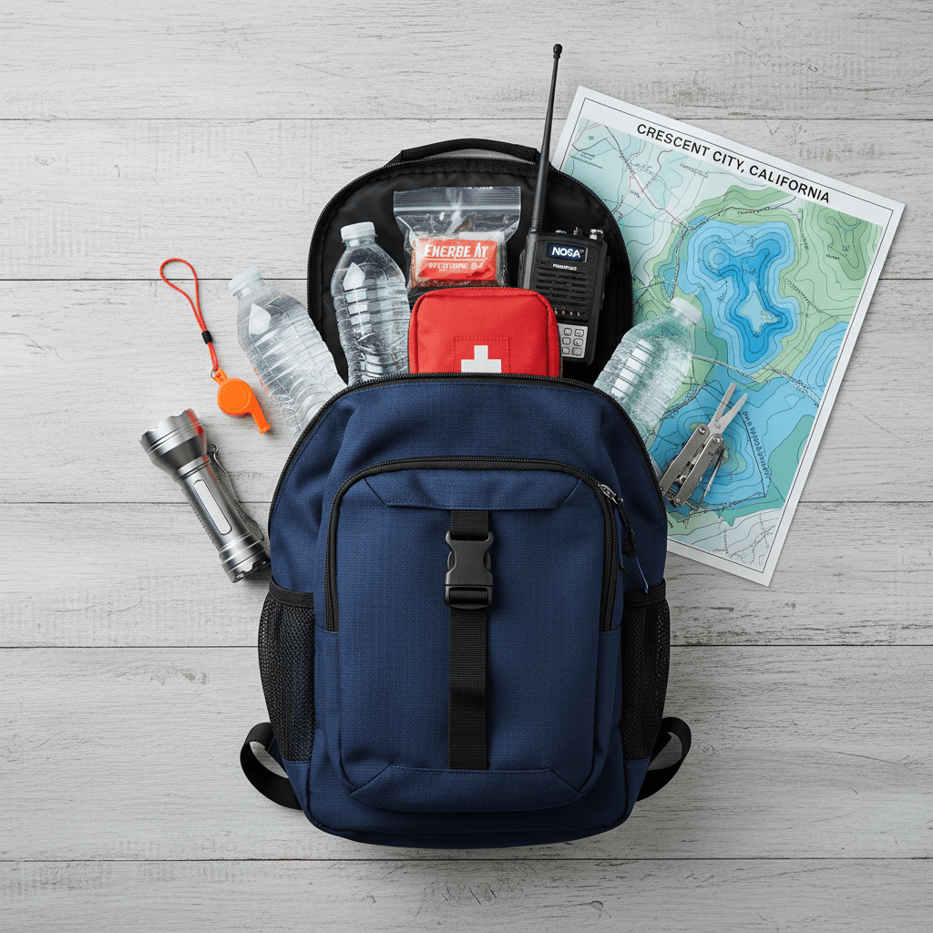
The standard FEMA recommendation, three days of water, food, and medications, is a floor, not a ceiling. For Crescent City, where road closures from either fire or post-tsunami debris can extend isolation well beyond 72 hours, two weeks of supplies is a more realistic target. One gallon of water per person per day is the minimum; in a fire evacuation scenario with smoke inhalation risk, that figure goes up.
Our Top Picks at a Glance
| Product | Best For |
|---|---|
| Alive After the Fall | Coastal Survival Planning |
| Home Doctor | Emergency Medical Care |
Alive After the Fall. Coastal Survival When Infrastructure Fails
Alive After the Fall addresses the scenario that follows the immediate emergency: what happens when power, supply chains, and communications stay down for an extended period. For Crescent City, that scenario is plausible under both a major tsunami and a catastrophic wildfire that severs Highway 101. The guide walks through food and water management, shelter priorities, and decision-making frameworks for situations where outside help is delayed by days rather than hours. It’s the kind of reference that’s useless if you read it after the fact, store it somewhere you can grab in 90 seconds.
📦 Recommended: Home Doctor
When emergency services are stretched thin or unreachable, this practical medical guide shows you how to handle injuries and illness at home — an essential reference for any disaster plan.
Home Doctor. When the ER Is Unreachable
After a major surge or a fire that cuts off Highway 101, Sutter Coast Hospital in Crescent City will be overwhelmed quickly, and mutual aid from larger regional centers in Eureka takes time to arrive under normal conditions, let alone after a declared disaster. Home Doctor is built for exactly this gap: treating lacerations from debris, managing infection without a pharmacy run, and stabilizing injuries when you can’t get a patient to a professional within the hour. California’s chemical release declaration in May 2026 is a reminder that post-event contamination and respiratory issues are also realistic scenarios for which basic first-aid knowledge is insufficient. This guide fills that gap without requiring medical training to follow.
📦 Recommended: The Lost Superfoods
A long-shelf-life emergency food supply keeps your household fed when stores are empty and supply chains are disrupted — a core layer of any preparedness plan.
Monitoring: What to Watch and Where
For tsunami risk, the National Tsunami Warning Center (tsunami.gov) is the authoritative source. Sign up for Del Norte County emergency alerts through the county’s official notification system, these will push to your phone faster than a broadcast siren reaches a moving vehicle. For wildfire and weather events, weather.gov/eka covers the Eureka forecast office, which is responsible for Del Norte County watches and warnings. Cal Fire’s incident page updates faster than most local news during an active fire. Bookmark both and check them before any planned outdoor activity during fire season.
A battery-powered or hand-crank NOAA weather radio remains the most reliable fallback when cell networks saturate during an emergency. Crescent City’s geography means cell coverage degrades quickly once you move away from the waterfront corridor, making offline tools essential rather than optional.
Frequently Asked Questions
California has had 121 fire declarations since 2016, does that affect tsunami preparedness planning in Crescent City?
Directly, yes. The evacuation routes that take residents away from tsunami inundation zones, primarily roads heading uphill and east, overlap with the routes that can be cut by wildfire. Planning for one hazard without accounting for the other leaves gaps. Crescent City residents should identify evacuation paths for both scenarios and understand which roads remain passable when Highway 101 is closed.
If a Cascadia Subduction Zone earthquake hits, how much time do residents near the Crescent City harbor have before wave arrival?
NOAA and USGS modeling suggests a local-source Cascadia tsunami could reach Crescent City’s shoreline in as little as 15 to 20 minutes after rupture, potentially less at certain tidal conditions. This is why natural warning signs (violent, sustained shaking lasting more than 20 seconds) are treated as the evacuation trigger, not an official siren. At that margin, waiting for confirmation costs time you don’t have.
California had a federally declared chemical release in May 2026, what does that mean for general preparedness in coastal communities?
It’s a reminder that the disaster profile here isn’t limited to fire and seismic events. A chemical release can require shelter-in-place rather than evacuation, the opposite action from a tsunami response. Every household should know both protocols and have the materials to execute either: sealed windows and interior shelter capacity for a chemical event, and a pre-packed go-bag and confirmed route to high ground for a coastal emergency. FEMA’s ready.gov outlines both procedures, and fema.gov maintains current declarations by state for situational awareness.
Get real disaster prep, decoded from FEMA, NOAA & USGS.
One short email when something actually matters for your zip code. No spam, ever.