Last Updated: July 2026 | Based on FEMA, NOAA, and USGS data
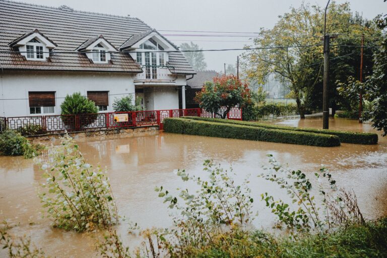
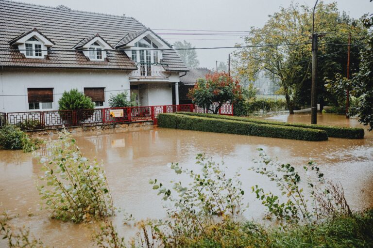
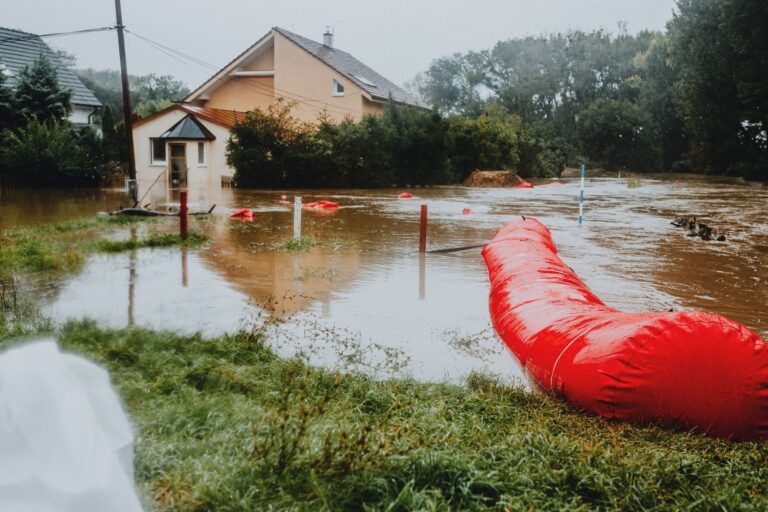
Since 2016, Texas has recorded 32 federally declared disasters. Four of them were floods. Three of those flood declarations have landed since May 2025, including one as recent as July 2026. If you live in San Antonio, that pattern is not background noise. The Balcones Escarpment, which cuts directly through Bexar County, is one of the most flood-dangerous geological features in the continental United States. Rain that falls on the limestone Hill Country has almost nowhere to absorb, it moves fast, it moves in volume, and it reaches San Antonio neighborhoods before most alert systems have finished their first broadcast cycle. Our Flood Preparedness guide covers how to prepare for water that moves that fast.
Your county's real disaster history, what to do first, and what to keep at home. Free, and it shows up right here.
🔒 We never sell your email. Unsubscribe in one click.
This page is built around the actual Texas FEMA declaration record, not a generic national template. The action steps below reflect what that data, and the specific hydrology of South-Central Texas, actually demands.
📊 TX Federally Declared Disasters (2016–2026)
32 major disaster declarations were issued for TX in this period, according to FEMA records.
| Disaster type | Declarations |
|---|---|
| Fire | 20 |
| Flood | 4 |
| Hurricane | 4 |
| Severe Ice Storm | 2 |
| Winter Storm | 1 |
| Biological | 1 |
Most recent declarations
| Date | Type | Event |
|---|---|---|
| 2026-07-18 | Flood | Flooding |
| 2026-05-18 | Fire | Stinky Fire |
| 2026-05-14 | Fire | Hunggate Fire |
| 2026-03-15 | Fire | Corner Pocket Fire |
| 2026-02-18 | Fire | 8 Ball Fire |
| 2025-07-06 | Flood | Severe Storms, Straight-Line Winds, And Flooding |
Source: FEMA OpenFEMA Disaster Declarations · retrieved 2026-07-19 by US Risk Radar.
📋 Print this checklist, keep it with your emergency supplies.
Flash Flood Alley Is Not a Metaphor
San Antonio sits at the southern end of a corridor meteorologists call Flash Flood Alley, a stretch running from Del Rio northeast through Austin. The limestone karst terrain drains almost no water, runoff ratios here can exceed 90 percent during intense storms. When a slow-moving thunderstorm stalls over the Hill Country, Salado Creek, Leon Creek, and the San Antonio River can rise several feet within 45 minutes.
The July 2026 federal flood declaration and the two 2025 flood declarations (May and July) were not flukes. They follow a pattern NOAA has documented for decades: late spring through midsummer moisture pumped north from the Gulf of Mexico collides with elevated terrain and produces rainfall rates the urban drainage system simply cannot handle.
What that means practically: your warning window is shorter here than almost anywhere else in the country. A flash flood watch issued by the NWS Austin/San Antonio office should be treated as preparation time, not observation time. A warning means it is already happening somewhere upstream.
Before the Next Watch Is Issued
- ☐ Look up your specific flood zone now, not during a watch. Enter your address at the FEMA Flood Map Service Center. Properties near Salado Creek, Culebra Creek, and the Mitchell Lake area carry elevated Zone AE risk. Knowing your zone before a storm means you can make a go/stay decision without scrambling.
- ☐ Identify your nearest high ground and your route to it. Map two routes out of your neighborhood, flood events routinely close low-water crossings on Military Drive, Zarzamora Street, and along Loop 410 near creek crossings. A route that works in dry conditions may be underwater in 40 minutes.
- ☐ Sign up for City of San Antonio OEM alerts and enable Wireless Emergency Alerts on your phone. Do not rely on one channel. NWS issues the warning; the city translates it to ground-level action; your phone pushes the alert. All three need to be active.
- ☐ Check your flood insurance status. Standard homeowners policies exclude flood damage, this is not a technicality, it is a complete exclusion. Coverage through the National Flood Insurance Program (NFIP via FEMA) takes 30 days to activate. That policy needs to exist before storm season, not after.
- ☐ Clear every drainage path on your property. Gutters, downspouts, the curb cut in front of your house, any low point in your yard that borders a neighbor’s fence. Blocked drainage during a 4-inch-per-hour rain event turns a manageable situation into a foundation problem.
- ☐ Photograph and video your entire home interior. Open every closet, every cabinet. Insurance adjusters work from documentation. A 10-minute walkthrough video stored in cloud backup has settled claims that would otherwise have been disputed for months.
- ☐ Move irreplaceable items above your projected flood line. FEMA flood maps show base flood elevation for your parcel. Anything below that line, documents, electronics, medications, family records, should be stored higher or in waterproof containers.
Your Emergency Supply Baseline
Flood events in San Antonio do not always trigger long multi-day displacements, but road closures regularly isolate neighborhoods for 24 to 72 hours. Build your kit around that realistic scenario first, then extend it.
- Water: one gallon per person per day, minimum three days. Store in sealed containers away from direct sunlight.
- Food that requires no cooking and no refrigeration, floods frequently knock out power. Three days minimum, seven days preferred.
- Battery-powered or hand-crank NOAA Weather Radio with tone alert. Cell networks degrade under surge load during emergencies.
- Flashlight, headlamp, and spare batteries.
- Complete first-aid kit, plus a 7-day supply of any prescription medications sealed in waterproof bags.
- Copies of insurance policies, identification, and medical records in a waterproof document pouch, keep one set at home and one offsite or in cloud storage.
- Wrench or pliers to shut off gas and water at the main.
- Cash in small bills. ATMs and card readers go down when power does.
- Phone charging bank (fully charged before storm season starts).
- Dust mask or N95 respirator, floodwater in urban environments carries sewage contamination.
📦 Recommended: The Lost Superfoods
Ensure your household has reliable, long-lasting nutrition when local grocery stores become inaccessible due to road closures or flood damage.
When the Warning Drops
- Do not wait to see if it gets worse. If you are in a low-lying area and a Flash Flood Warning is issued, the decision window to leave safely is measured in minutes, not hours. Delayed evacuations during creek rises are the leading cause of flood fatalities in Bexar County.
- Never drive through water covering a road. Six inches of moving water can stall most passenger vehicles. Two feet of water will carry an SUV. Bexar County low-water crossings are marked with depth gauges, if the gauge is submerged, the crossing is closed, full stop. Turn Around, Don’t Drown is a federal campaign for a reason: the majority of flood deaths in Texas involve vehicles.
- If your car stalls in rising water, get out immediately. Move perpendicular to the flow toward higher ground. Do not stay with the vehicle waiting for water to recede.
- Avoid all contact with floodwater. San Antonio’s storm drain network connects to the same infrastructure as its wastewater system in certain older sections of the city. Floodwater here is not rainwater, it carries pathogens, chemical runoff, and debris.
- Keep monitoring NWS updates at weather.gov even after rain stops locally. Upstream releases from Medina Lake or continued Hill Country runoff can raise local creeks for hours after skies clear.
After the Water Drops
- Wait for an official all-clear before returning. Structurally compromised foundations and downed power lines are not visible from a car window in the dark.
- Document damage before touching anything. Photograph every room, every damaged item, every waterline mark on your walls. This is your claim file.
- Call your insurer the same day. NFIP claims have documentation timelines. Delays cost policyholders money.
- Wear protective gear during cleanup. N95 mask minimum, rubber gloves, rubber boots. Discard any porous material, carpet, drywall, upholstered furniture, that absorbed floodwater. Mold colonization in San Antonio’s humidity begins within 24 to 48 hours.
- Have your gas line inspected before relighting pilots. CPS Energy has an emergency line for post-flood gas checks.
Frequently Asked Questions
Texas has 20 fire declarations since 2016 but only 4 floods, why focus so much on flooding in San Antonio?
The wildfire declarations are concentrated in West Texas and the Panhandle, where fuel loads and wind conditions are very different from Bexar County’s urban-suburban environment. San Antonio’s specific geography, the Balcones Escarpment, the creek network running through the city, and its position at the southern end of Flash Flood Alley, makes flooding the dominant life-safety risk locally. Three of Texas’s four flood declarations since 2016 occurred in 2025 and 2026, signaling an accelerating pattern for South-Central Texas specifically.
My neighborhood didn’t flood last year. Do I still need flood insurance?
FEMA flood maps reflect historical data, not predictive ceilings. Roughly 25 percent of NFIP claims nationally come from properties outside high-risk zones. More directly: the May 2025 and July 2025 federal flood declarations in Texas affected areas that had not flooded in the prior five-year period. The 30-day waiting period for NFIP coverage means the time to evaluate this is now, not when a watch is posted.
How fast can San Antonio creeks rise during a major storm?
The NWS Austin/San Antonio office has documented rises of 20 feet or more on Salado Creek within a single storm event. The record rise on the San Antonio River near the Olmos Basin occurred in under two hours. These are not edge-case scenarios, they are the documented behavior of these waterways under the rainfall intensities that occur multiple times per decade in this region. That rate of rise is why the NWS repeatedly emphasizes that a Flash Flood Warning, not a watch, is already an emergency in progress.
Sources
- FEMA.gov. Disaster Declarations and NFIP
- National Weather Service. Austin/San Antonio
- USGS.gov. Streamflow and flood data
- City of San Antonio Office of Emergency Management
This article is for informational purposes only. Always follow directives from local emergency management authorities.
Get real disaster prep, decoded from FEMA, NOAA & USGS.
One short email when something actually matters for your zip code. No spam, ever.