Last Updated: April 2026 | Based on FEMA, NOAA, and USGS data
Kentucky has recorded 20 federally declared disasters since January 2016, roughly two per year, every year, without pause. The most recent: a severe winter storm declaration in May 2026, which is a strange sentence to read but an accurate one. Louisville sits at the intersection of nearly every threat category on that list: severe storms, flooding, tornadoes, and in 2024, even the remnants of Hurricane Helene reached Jefferson County. If you’ve been treating flood prep as your only task here, the record says otherwise. Our Flood Preparedness guide is still the right starting point for that flood piece.
Your county's real disaster history, what to do first, and what to keep at home. Free, and it shows up right here.
🔒 We never sell your email. Unsubscribe in one click.
This isn’t a guide about being prepared in general. It’s built around what FEMA has actually declared in Kentucky, ten severe storm events, three floods, two tornadoes, two winter storms, and a tropical storm system, and what those patterns mean for a Louisville household right now.
📊 KY Federally Declared Disasters (2016–2026)
20 major disaster declarations were issued for KY in this period, according to FEMA records.
| Disaster type | Declarations |
|---|---|
| Severe Storm | 10 |
| Flood | 3 |
| Winter Storm | 2 |
| Tornado | 2 |
| Tropical Storm | 1 |
| Severe Ice Storm | 1 |
| Biological | 1 |
Most recent declarations
| Date | Type | Event |
|---|---|---|
| 2026-05-29 | Winter Storm | Severe Winter Storm |
| 2026-01-24 | Winter Storm | Severe Winter Storm |
| 2025-05-23 | Severe Storm | Severe Storms, Straight-Line Winds, And Tornadoes |
| 2025-04-24 | Severe Storm | Severe Storms, Straight-Line Winds, Tornadoes, Flooding, Landslides, And Mudslides |
| 2025-04-03 | Severe Storm | Severe Storms, Straight-Line Winds, Tornadoes, And Flooding |
| 2025-02-24 | Severe Storm | Severe Storms, Straight-Line Winds, Flooding, Landslides, And Mudslides |
Source: FEMA OpenFEMA Disaster Declarations · retrieved 2026-07-19 by US Risk Radar.
Severe Storms Are the Dominant Threat. Flooding Follows Them
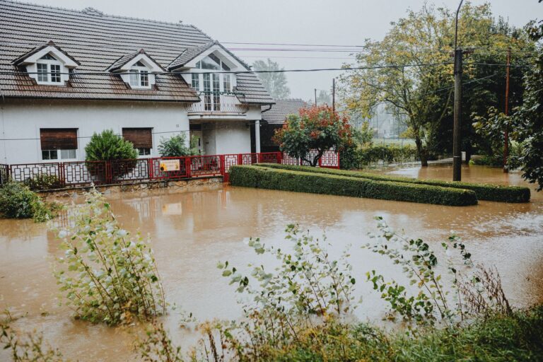
Ten of Kentucky’s 20 federal disaster declarations since 2016 involve severe storms, and if you read the full titles in the FEMA record, nearly every one of them appends “flooding” or “landslides” to the headline. The April 2025 declaration, Severe Storms, Straight-Line Winds, Tornadoes, Flooding, Landslides, and Mudslides, is essentially a checklist of what a single weather system can do to Louisville in one pass.
Straight-line winds are underestimated. Unlike tornadoes, they don’t produce a visible funnel, but sustained gusts above 70 mph can bring down the same trees, the same power lines, and block the same evacuation routes. When those winds arrive with heavy rain, which in Louisville they frequently do, basement flooding and road flooding happen simultaneously, while downed limbs and debris make driving dangerous.
Before the next severe storm season:
- ☐ Trim or remove trees with large limbs overhanging your roof, power lines, or vehicles. Louisville’s urban canopy is an asset until a storm turns it into a liability.
- ☐ Clear gutters and downspouts now, not the day rain is forecast. Clogged drainage accelerates basement water intrusion during fast-moving storms.
- ☐ Identify your circuit breaker and gas shutoff locations before an emergency. Practice locating them in low light.
- ☐ Verify your property’s flood zone status at the FEMA Flood Map Service Center. Louisville Metro’s creek and river basin maps are more granular than federal zone boundaries.
- ☐ Sign up for Louisville Metro Emergency Alerts (LENSAlert), text and app notifications, not just sirens.
- ☐ Review your homeowners insurance. Standard policies exclude flood damage. If you’re in or near a Special Flood Hazard Area, a separate National Flood Insurance Program (NFIP) policy has a mandatory 30-day waiting period, don’t buy it when a storm is already named.
- ☐ Install check valves on plumbing drain lines to block sewage backflow when storm systems overwhelm Louisville’s combined sewer infrastructure.
The Ohio River and Flash Flood Windows
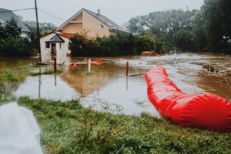
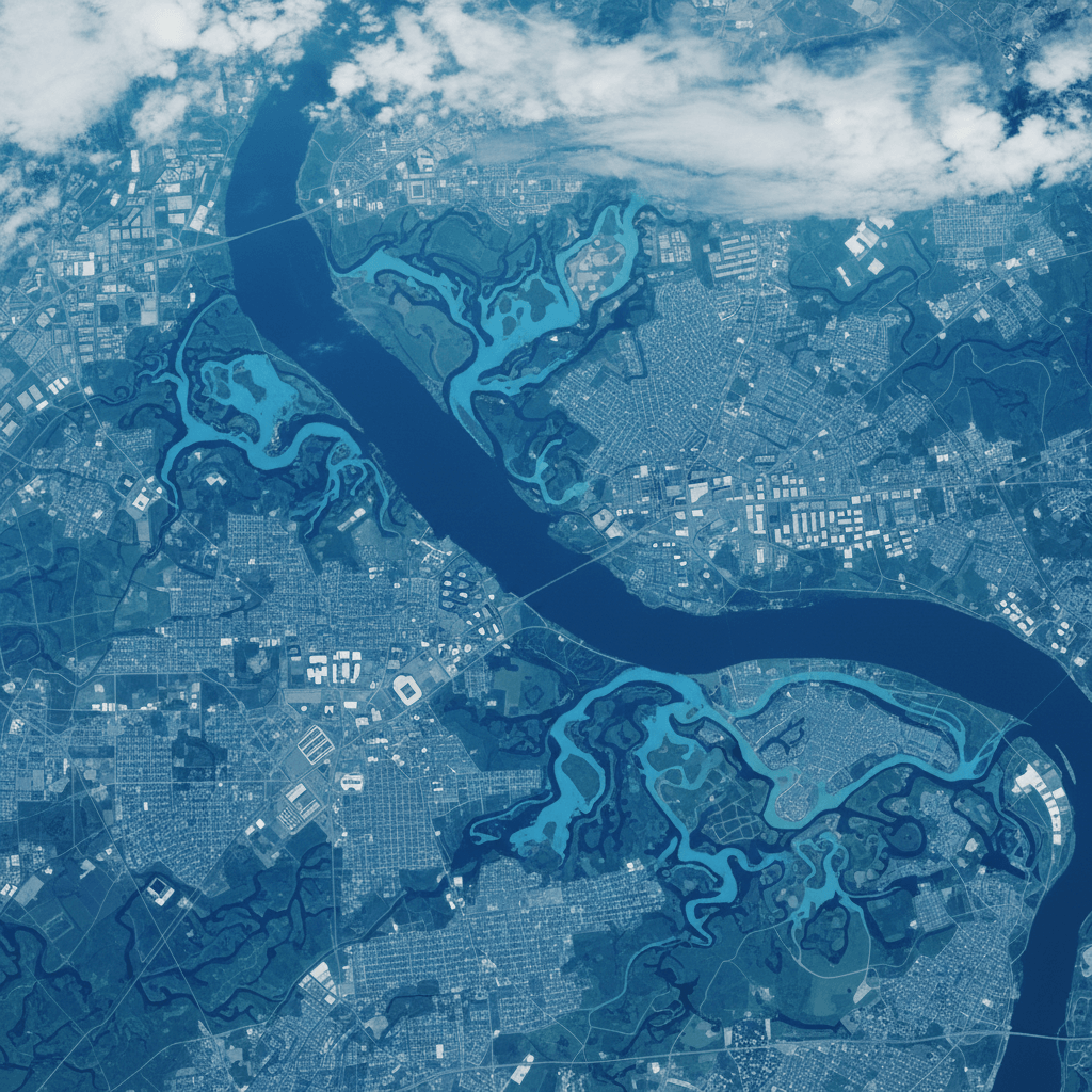
Louisville’s flood risk has two distinct modes. The first is Ohio River flooding, slow-rising, forecast days in advance by the National Weather Service Louisville office, affecting low-lying neighborhoods like Shawnee, Portland, and sections of the West End. The second is flash flooding from Beargrass Creek and its tributaries, fast, sometimes under an hour of warning, and capable of inundating streets that don’t appear on flood maps because the risk comes from surface runoff rather than mapped floodplain zones.
The distinction matters because your response time is different. Ohio River rises give you a preparation window. Flash floods during a severe storm do not.
If a flood watch or warning is issued for Jefferson County:
- Monitor the NWS Louisville forecast page for river gauge readings, not just weather summaries.
- Move vehicles to higher ground before water reaches roadway level, not after.
- Turn off electrical panels in basements if water is rising toward them; do not re-enter to do this once standing water is present.
- Six inches of moving water can knock an adult down. Twelve inches can carry a small vehicle. Do not drive through flooded roadways regardless of how shallow the water appears.
- If you are told to evacuate, leave using the designated route. Improvising alternate routes during active flooding kills people every year in Kentucky.
Winter Storms That Arrive in May (Yes, Really)
The May 2026 severe winter storm declaration is not a data entry error. Kentucky’s geography, sitting at the edge of cold Arctic air masses and warm Gulf moisture, means ice and snow events can arrive outside conventional winter months. Two of the state’s last 20 federal disaster declarations are winter storms, and both came within the 2024–2026 window.
For Louisville, the specific hazard is ice accumulation on power lines and roads, not snowfall depth. A half-inch of ice can cause multi-day outages across Jefferson County. Households that prepared only for flooding find themselves without heat, without a way to charge medical equipment, and unable to leave.
Cold-weather additions to your emergency kit:
- Propane or kerosene heater rated for indoor use, with extra fuel stored safely outside the living space.
- Wool blankets or a sleeping bag rated to 0°F per person.
- At least 72 hours of food that requires no cooking or minimal preparation.
- Ice melt and sand for steps and exits, mobility around your property matters if you need to reach a vehicle or check a generator.
- A battery or car-powered phone charger for maintaining communication when the grid is down for days, not hours.
Your Core Emergency Kit. Built for Louisville’s Actual Hazard Mix
A generic 72-hour kit works as a baseline. What follows is that baseline adjusted for a household in Louisville’s specific threat environment, severe storms that can combine flooding, wind damage, and power loss in the same event.
- One gallon of water per person per day, minimum three days. Store more if you have infants, elderly household members, or pets.
- Non-perishable food for 72 hours minimum, ideally one week. Prioritize items that don’t require refrigeration or cooking if power is out.
- Battery-powered or hand-crank NOAA weather radio, when cell towers are overloaded during a major storm, this is your most reliable alert source.
- Flashlight with extra batteries and at least one headlamp (hands-free matters during cleanup).
- First aid kit with a two-week supply of prescription medications and copies of prescriptions in a waterproof bag.
- Multi-purpose tool capable of shutting off gas and water valves.
- Waterproof bag or container holding copies of: photo ID, insurance cards, NFIP policy number, vehicle title, and a written list of emergency contacts.
- Cash in small bills. ATMs fail during extended outages.
- Whistle for signaling if trapped.
- N95 masks, useful both during mold remediation after flooding and during any biological event (Kentucky’s disaster record includes one federal biological declaration).
- Manual can opener.
- Local road maps printed on paper. GPS is unreliable when towers go down or roads are rerouted.
📦 Recommended: The Lost Superfoods
When floods isolate neighborhoods, access to fresh supplies is often disrupted. This guide provides reliable methods for storing nutrient-dense food that lasts years, ensuring your family stays nourished during emergency recovery.
After the Water Recedes: Recovery Without Making It Worse
- Do not re-enter a flooded structure until Louisville Metro or local fire officials have cleared it. Standing water may be electrically charged from submerged outlets or downed exterior lines.
- Photograph and video every room and every damaged item before moving or discarding anything. Insurance adjusters need documentation, and discarding items prematurely can reduce your claim.
- Wear rubber boots, nitrile gloves, and an N95 when entering a flood-damaged space. Louisville’s combined sewer system means floodwater frequently contains raw sewage.
- Discard any food, medicine, or cosmetics that contacted floodwater. This includes canned goods with compromised labels or dented seams.
- Call your insurance provider before beginning any structural repairs. Most policies require damage to be documented in its original state.
- Report damage to FEMA at fema.gov if a federal disaster declaration covers your event. Individual Assistance registration has deadlines, typically 60 days from the declaration date.
Frequently Asked Questions
Kentucky has had 20 federal disaster declarations since 2016, why does my neighborhood feel like it’s never affected?
Federal disaster declarations cover the state or specific counties, not every neighborhood equally. Many Louisville residents in higher-elevation areas don’t experience direct flooding but lose power for days due to storm damage, which is still a declared disaster scenario. The FEMA record reflects cumulative county-level impact, and Jefferson County appears in multiple declarations. Your risk may be power outage and structural wind damage rather than inundation, which still requires a stocked kit and a communication plan.
Hurricane Helene hit Kentucky in 2024, should I be preparing for tropical systems?
Yes, with realistic expectations. Tropical remnants reaching Louisville don’t bring coastal storm surge, but they deliver sustained heavy rainfall over already-saturated ground, which accelerates flash flooding on Beargrass Creek and its tributaries. The November 2024 Helene declaration for Kentucky is a concrete example. Watch the National Weather Service Louisville office for tropical moisture advisories during late summer and fall, not just spring storm season.
Is flood insurance actually worth buying if I’m not in a mapped floodplain?
FEMA’s own data shows roughly 20% of flood insurance claims come from properties outside high-risk flood zones. Louisville’s flash flooding from creek tributaries and surface runoff affects streets that don’t appear on official floodplain maps. NFIP policies are available to any property in a participating community regardless of zone, and Louisville Metro participates. The 30-day waiting period makes this a decision for now, not when a storm is forecast.
Get real disaster prep, decoded from FEMA, NOAA & USGS.
One short email when something actually matters for your zip code. No spam, ever.