Last Updated: July 2026 | Based on FEMA, NOAA, and USGS data
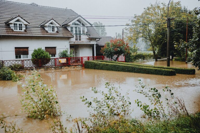
Texas has had 32 federally declared disasters since 2016. That number alone should reshape how Austin residents think about emergency planning, because the threat isn’t hypothetical, and it isn’t evenly distributed. The dominant driver is wildfire: 20 of those 32 declarations were fire-related. But for people living along Shoal Creek, the Colorado River corridor, or anywhere in Travis County’s lower-lying neighborhoods, it’s the 4 flood declarations that hit closest to home. Two of them came within weeks of each other in 2025. A third landed in July 2026. The pattern is clear: Texas floods fast, and Austin is squarely in that pattern. Our Flood Preparedness guide covers what that pattern means for your household.
Your county's real disaster history, what to do first, and what to keep at home. Free, and it shows up right here.
🔒 We never sell your email. Unsubscribe in one click.
This guide works through what that record actually means for your household, not generic advice, but prep steps shaped by the specific disasters Texas keeps declaring.
📊 TX Federally Declared Disasters (2016–2026)
32 major disaster declarations were issued for TX in this period, according to FEMA records.
| Disaster type | Declarations |
|---|---|
| Fire | 20 |
| Flood | 4 |
| Hurricane | 4 |
| Severe Ice Storm | 2 |
| Winter Storm | 1 |
| Biological | 1 |
Most recent declarations
| Date | Type | Event |
|---|---|---|
| 2026-07-18 | Flood | Flooding |
| 2026-05-18 | Fire | Stinky Fire |
| 2026-05-14 | Fire | Hunggate Fire |
| 2026-03-15 | Fire | Corner Pocket Fire |
| 2026-02-18 | Fire | 8 Ball Fire |
| 2025-07-06 | Flood | Severe Storms, Straight-Line Winds, And Flooding |
Source: FEMA OpenFEMA Disaster Declarations · retrieved 2026-07-19 by US Risk Radar.
Flash Flood Alley Is Not a Metaphor
Austin sits inside what hydrologists call Flash Flood Alley, a belt running from Del Rio northeast through San Antonio and Austin where the limestone Edwards Plateau funnels rainfall into watersheds with almost no absorption capacity. When a storm drops two inches an hour over the Hill Country, that water doesn’t soak in. It runs. Shoal Creek can go from trickle to torrent in under 30 minutes. Onion Creek, Walnut Creek, and Waller Creek behave the same way.
The May 2025 FEMA declaration for “Severe Storms and Flooding” and the July 2025 declaration for “Severe Storms, Straight-Line Winds, and Flooding” weren’t anomalies, they were the system working exactly as it always has. NOAA’s Austin/San Antonio Weather Forecast Office at weather.gov/ewx consistently ranks flash flooding as the region’s top weather killer, ahead of tornadoes and heat.
Check your specific address against the City of Austin FloodPro map and the FEMA Flood Map Service Center. If you’re not in a mapped floodplain, don’t stop there. FEMA estimates that roughly 25% of flood insurance claims come from properties outside high-risk zones, and Austin’s rapid development keeps creating new runoff patterns that older maps don’t reflect.
What the Fire Record Means for Austin Households
Twenty of Texas’s 32 federal disaster declarations since 2016 were wildfires. Four fires received declarations in early 2026 alone. Austin itself sits at an urban-wildland interface, neighborhoods like West Lake Hills, Bee Cave Road corridors, and areas backing up to the Barton Creek Greenbelt all carry meaningful fire exposure, and Central Texas has spent years cycling through drought conditions that dry out the cedar and scrub oak that blanket the Hill Country.
This matters for Austin flood preppers specifically because the same kit and the same go-plan cover both emergencies. A family with a packed go-bag and a practiced evacuation route is ready whether the alert comes from rising water on Lamar or smoke pushing east from Bastrop County. The fire declarations aren’t a separate conversation, they’re a reason to take the whole preparedness infrastructure more seriously.
If you’re near the greenbelt or any of the wooded creek corridors, keep your defensible space cleared (TxDOT and Travis County Watershed Protection both publish guidance), and make sure your evacuation plan doesn’t route you through a single exit that could be cut off by either fire or flood.
Building the Go-Plan: Flood-First, Fire-Ready
Most Austin households don’t fail at preparedness because they lack information. They fail because the plan was never specific enough to survive an actual 2 a.m. emergency. These steps are meant to be concrete.
Know Your Trigger, Not Just Your Risk
A Flood Watch from NWS Austin means conditions are favorable, start monitoring and confirm your kit is ready. A Flood Warning means flooding is imminent or occurring, that’s your cue to move if you’re in a low-lying area, not a cue to wait and see. Don’t make that decision in real time. Decide now which NWS alert level is your personal “we leave” threshold and tell everyone in your household.
Sign up for WarnCentralTexas alerts. They push directly to your phone with geographic specificity that broadcast weather can’t match.
Map Your Routes Before the Water Rises
Identify two routes out of your neighborhood to high ground, not just “head north.” Know which roads dip under creek crossings (Loop 360 at Bull Creek, Barton Springs Road at Barton Creek, Slaughter Lane underpasses) and treat those as blocked by default once a warning is issued. A dry-run drive on a normal day takes 15 minutes and could save your life.
Secure the House for a Fast Exit
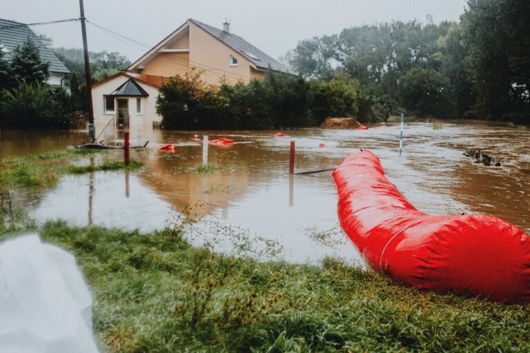
Clear your gutters before the spring and fall peak seasons. If you’re in a flood-prone area, sandbags are available through the City of Austin at no cost during declared events, but the line gets long fast. A set of pre-positioned door flood barriers or even heavy-duty sandbags stored in your garage buys time. Elevate water heaters and electrical panels if you’re in a ground-floor unit or a home that’s flooded before.
The Kit That Actually Gets Grabbed
A kit nobody uses is just clutter. Keep core supplies in one bag near the door:
- Three days of water, one gallon per person per day, stored in sealed containers
- Non-perishable food that doesn’t require cooking (a flooded neighborhood often means no gas, no power)
- Battery-powered or hand-crank NOAA weather radio
- Flashlight with fresh batteries, plus a headlamp for hands-free use during cleanup
- First aid kit with at least a 7-day supply of any prescription medications
- Waterproof bag containing copies of insurance documents, IDs, and a printed list of emergency contacts
- Cash in small bills. ATMs and card readers go down when power goes out
- N95 masks for post-flood mold and debris cleanup
- Wrench or pliers to shut off gas and water
📦 Recommended: The Lost Superfoods
When flooding disrupts access to grocery stores, having a long-lasting emergency food supply is crucial for your family’s stability.
Insurance: The Gap Most Austin Residents Don’t Know They Have
Standard homeowner’s insurance does not cover flood damage. That’s not fine print, it’s a categorical exclusion. Flood coverage requires a separate policy through the National Flood Insurance Program (NFIP), which you can find through your existing insurer, or through a private flood insurer. NFIP policies typically take 30 days to go into effect, so buying one after a Flood Watch is issued is too late.
Given that Travis County has received multiple federal flood declarations in back-to-back years, the probability argument for coverage has shifted. Review your policy, call your agent, and ask specifically: “Do I have flood coverage?” Don’t assume.
After the Water Recedes
Post-flood cleanup carries risks that catch people off guard. Do not enter a flooded structure until Austin Energy and Austin Water have confirmed utilities are safe, electrocution and gas leaks kill people in the recovery phase, not just during the event. Document all damage with photos and video before moving anything, and contact your insurer before beginning major cleanup. FEMA disaster assistance may also be available if Travis County is included in a declaration, check fema.gov for open registration periods.
If neighbors were affected, check on those with limited mobility once conditions are safe. Report downed power lines, gas smells, or structural hazards to 311 rather than attempting to address them yourself.
Frequently Asked Questions
Texas had more wildfire declarations than flood declarations since 2016, should Austin residents prioritize fire prep over flood prep?
Both belong in the same plan, not competing ones. The go-bag, evacuation routes, and alert registrations serve either emergency. That said, flood risk is more immediate for most Austin residents given the city’s creek network and drainage patterns, the 2025 flood declarations both covered the greater Austin area directly. Wildfire risk is higher for households on the western edge of the city near the Barton Creek Greenbelt or backing up to cedar-heavy Hill Country terrain.
Two flood disasters were declared in Texas in a two-month window in mid-2025. Is that unusual?
It reflects a pattern rather than a fluke. Central Texas sits at the convergence of Gulf moisture and dry continental air masses, which produces extreme precipitation events that can repeat within a single season. NOAA’s historical data for the Austin/San Antonio region shows multiple high-water events in the same spring season are more common than not. Planning for one flood event per season is insufficient, prepare for the possibility of back-to-back disruptions.
How do I find out if my specific address has flooded before, not just whether it’s in a mapped floodplain?
The City of Austin’s FloodPro tool shows floodplain boundaries and historical flood complaint data by address. Travis County also maintains drainage complaint and flood damage records through its Watershed Protection Department. Both are free to search and more granular than FEMA’s national flood maps, which can lag years behind Austin’s development-driven changes to local drainage.
Get real disaster prep, decoded from FEMA, NOAA & USGS.
One short email when something actually matters for your zip code. No spam, ever.