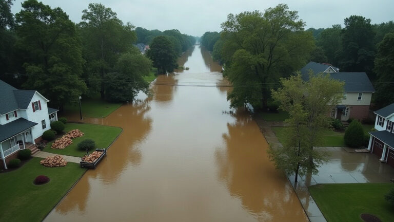

Is my house in a flood zone? You can find the answer in under five minutes: go to the FEMA Flood Map Service Center (MSC), enter your address, and read the flood zone label on the official Flood Insurance Rate Map (FIRM) for your property, as published by FEMA.
Your county's real disaster history, what to do first, and what to keep at home. Free, and it shows up right here.
🔒 We never sell your email. Unsubscribe in one click.
Affiliate disclosure: This article contains affiliate links. We may earn a commission from qualifying purchases, at no additional cost to you. As an Amazon Associate we earn from qualifying purchases.
What the FEMA Flood Map Actually Shows
FEMA’s Flood Insurance Rate Maps (FIRMs) are the official federal documents that define flood hazard boundaries for communities across the United States. They are built from engineering surveys, hydrology modeling, and local drainage data. The maps divide land into zones that reflect the estimated probability of flooding in any given year.
The most important boundary on any FIRM is the edge of the Special Flood Hazard Area (SFHA). The SFHA covers land with a 1-percent or greater annual chance of flooding, commonly called the 100-year floodplain. According to FEMA’s flood zone definitions (2024), properties inside an SFHA and carrying a federally backed mortgage are generally required by the lender to carry flood insurance.
The map also shows a narrower floodway, the channel of a stream plus adjacent land that must be kept clear to carry the base flood without raising water levels more than one foot. Building restrictions inside a floodway are stricter than in the broader SFHA.
A third number to note is the Base Flood Elevation (BFE), the estimated water surface height during a base flood event at a specific point. Your lowest floor elevation relative to the BFE is one of the primary factors in calculating your flood insurance premium under FEMA’s National Flood Insurance Program (NFIP).
How to Look Up Your Flood Zone by ZIP Code or Address
Follow these numbered steps to check your property’s status today.
- Go to msc.fema.gov.
- Type your full street address, including ZIP code, into the search bar and press Enter.
- Click the property pin that appears on the map.
- Read the flood zone label in the pop-up panel. Zones beginning with “A” or “V” are inside the SFHA. Zones beginning with “B,” “C,” or “X” are outside it.
- Click “View FIRMette” to download a printable excerpt of the official map centered on your address. Save this PDF for your insurance agent and mortgage servicer.
- Note the panel number, effective date, and BFE (if shown) at the top of the FIRMette. You will need these for any insurance or lender conversation.
Reading the Flood Zone Labels
| Zone | Flood Risk Level | Inside SFHA? | Flood Insurance Required by Federally Backed Lender? | BFE Shown on Map? |
|---|---|---|---|---|
| AE | High (1% annual chance) | Yes | Yes | Yes |
| AO | High, shallow sheet-flow flooding | Yes | Yes | Depth shown, not elevation |
| A | High (1% annual chance) | Yes | Yes | No |
| VE | High, coastal wave action | Yes | Yes | Yes |
| X (shaded) | Moderate (0.2% annual chance) | No | No | No |
| X (unshaded) | Low (less than 0.2% annual chance) | No | No | No |
| D | Undetermined | No | No | No |
Source: FEMA, Flood Zones (2024).
When the Map Changes: Preliminary FIRMs and Your Window to Act
FEMA periodically revises FIRMs as new hydrology data, drainage improvements, and development patterns change flood behavior. When FEMA releases a preliminary FIRM, that draft map is open for public comment before it becomes legally effective. The preliminary period is your leverage point.
Three things to check as soon as a preliminary map is released for your community:
- Whether your parcel has moved into, out of, or within the SFHA. Flood exposure can shift from one side of a street to the other based on culverts, drainage channels, and nearby construction.
- Whether your BFE has changed, because even a one-foot change in BFE can significantly affect your NFIP premium.
- Whether FEMA’s engineering data reflects current site conditions. If your survey data or drainage improvements differ from what the model shows, you can submit documentation during the comment period.
After a FIRM is finalized, correcting your zone designation requires a separate Letter of Map Amendment (LOMA) or Letter of Map Revision (LOMR) process, which takes longer and costs more. Check the FEMA LOMA page (2024) for current instructions if you believe your property was mapped incorrectly.
Insurance, Mortgages, and What a Zone Change Actually Costs You
If the finalized flood map places your home inside an SFHA for the first time, your mortgage servicer will typically send a letter requiring flood insurance within 45 days, under the terms of the National Flood Insurance Program (NFIP) (2024). That requirement is not optional if your loan is federally backed.
Standard homeowners insurance does not cover flood damage. That gap has caught property owners off guard in repeated flooding events across the country. If you are in or near a mapped floodplain and do not carry a separate flood policy, you are self-insuring a risk that federal data identifies as real.
Ask your insurance agent these specific questions before any new map takes effect:
- Does the preliminary or new map change my flood zone status, and when does that change take effect?
- If I purchase a policy before the map is finalized, can I be rated under the current, lower-risk designation?
- Does my existing homeowners policy cover any flood-related losses at all, or is there a complete gap?
Beyond the policy itself, budget for post-flood cash needs: emergency drying equipment, hotel stays if the home is uninhabitable, mold remediation, and replacement of items that sat in standing water. According to the FEMA NFIP overview (2024), just one inch of floodwater can cause significant damage to a home’s structure and contents.
Properties Outside the SFHA Still Face Real Flood Risk
Being in Zone X does not mean flooding is impossible. According to FEMA (2024), more than 20 percent of NFIP flood insurance claims come from properties outside high-risk flood zones. Heavy rainfall, overwhelmed storm drains, and development that changes how water drains across a neighborhood can all cause flooding on parcels that the FIRM shows as low risk.
The NOAA National Weather Service (2024) issues Flash Flood Watches and Warnings based on real-time rainfall and soil saturation data. Signing up for your county’s emergency alert system and monitoring weather.gov during heavy rain events costs nothing and can give you meaningful lead time regardless of what the FIRM says about your parcel.
What to Do If Your Address Is in a Flood Zone
- Download your FIRMette from msc.fema.gov and share it with your insurance agent.
- Get an elevation certificate from a licensed surveyor if your BFE is shown on the map. This document documents your lowest floor elevation and is used to calculate your NFIP premium accurately.
- Contact your community’s floodplain administrator (usually at your local planning or public works department) to ask about any in-progress map revisions or drainage projects.
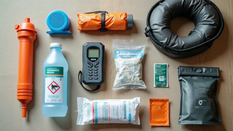
- Review the American Red Cross flood preparedness checklist (2024) and build a go-bag and home emergency supply kit.
- Identify two evacuation routes from your neighborhood, since floodwater can cut off roads quickly.
- Store important documents (deed, insurance policies, elevation certificate) in a waterproof container or a secure cloud backup.
What to Buy First
Before the next flood watch is issued, the single most useful physical barrier you can stage at home is the Quick Dam Grab and Go Flood Kit, which includes five 5-foot barriers and ten 2-foot bags, designed to be deployed at doorways and garage entries without any tools or water supply hookup.
Methodology
Flood zone definitions and FIRM lookup procedures are drawn from the FEMA Flood Map Service Center and FEMA NFIP program pages, extracted October 2, 2026. Insurance mandate thresholds and zone descriptions are sourced from FEMA’s official flood zone reference documentation, current as of the same date.
Updated: 2026-10-02
FAQ
Frequently asked questions
Is my house in a flood zone if it has never flooded before?
Yes, a property can carry a high-risk SFHA designation even with no flood history, because FEMA zones reflect statistical probability based on terrain and hydrology, not recorded events. Conversely, properties outside the SFHA have flooded in the past, so zone status and flood history are separate considerations.
How often does FEMA update flood maps?
FEMA revises Flood Insurance Rate Maps on a rolling basis as communities submit new engineering data, drainage improvements, or development changes, so there is no single national update cycle. You can check the effective date on your FIRMette at msc.fema.gov and sign up for map revision notifications through the FEMA Map Information eXchange at mymapnotifications.com.
Can I get flood insurance if I am not in a flood zone?
Yes, any property owner in an NFIP-participating community can purchase flood insurance regardless of flood zone designation, according to the FEMA NFIP program guidelines (2024). Premiums are generally lower for properties in Zone X, and more than 20 percent of NFIP claims come from outside high-risk zones.
What is a Letter of Map Amendment and when do I need one?
A Letter of Map Amendment (LOMA) is an official FEMA determination that a specific property has been incorrectly included in the SFHA based on a detailed elevation survey. You need one when your property is mapped inside a flood zone but your lowest ground elevation is at or above the Base Flood Elevation, which you can verify with a licensed surveyor’s elevation certificate.
Does being in Flood Zone X mean I do not need flood insurance?
Zone X means flood insurance is not required by a federally backed lender, but it does not mean flooding is impossible. FEMA data shows that a meaningful share of flood claims come from Zone X properties, and local drainage conditions or extreme rainfall can cause flooding well outside the mapped SFHA.
How long does it take for a preliminary FEMA flood map to become official?
After a preliminary FIRM is released, FEMA holds a public comment and appeal period that typically lasts 90 days, followed by a statutory 6-month compliance period before the map becomes effective, though exact timelines vary by community. Your local floodplain administrator can provide the schedule for your specific area.
Updated: October 02, 2026
- Potable Aqua Water Purification Tablets (50ct) $8-12
- LifeStraw Personal Water Filter $15-20
- Quick Dam Grab & Go Flood Kit – 5x 5ft Barriers & 10x 2ft Bags $20-30